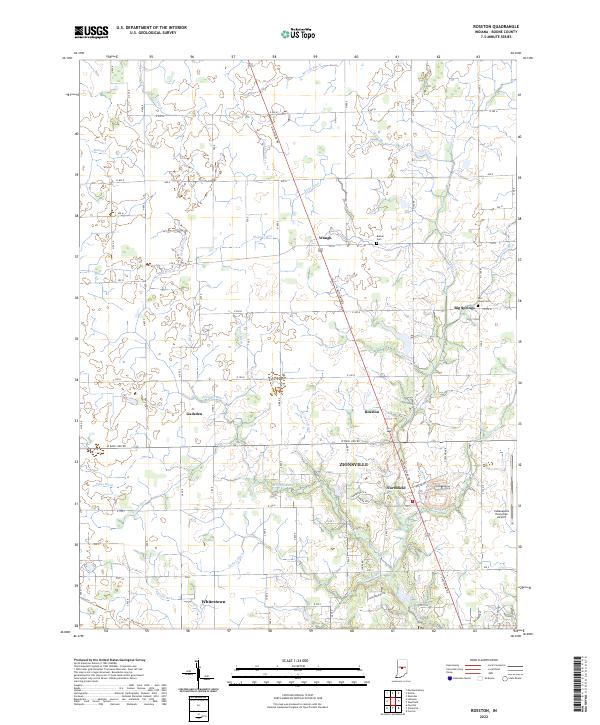
2022 Map of Rosston
USGS Topo · Published 2022About this map
Zionsville and Whitestown anchor the southern portion of this Boone County landscape, showing the suburban expansion into formerly rural townships. The drainage patterns of the central Indiana plains are heavily modified by an extensive network of man-made channels including McCoy Ditch, Campbell Ditch, and Davis Ditch, which support the region's agricultural productivity. Smaller historical hubs like Waugh, Gadsden, and Big Springs are interspersed among these fields, marking earlier centers of local commerce. Transportation history is visible in the route of the Big Four Trl, while modern regional connectivity is represented by the Indianapolis Executive Airport on the eastern edge. Local genealogy is preserved at sites like Bethel Cem and Parr- Jones Cem, situated near Eagle Creek and its various tributaries.
Find a feature on this map
46 named features on this map. Tap any name to fly to it.
Don’t see what you’re looking for? This feature index may not catch every label — zoom into the map to look around manually.
Map Details
Editions of this 2022 Rosston Map
This is the sole edition of this map. No revisions or reprints were ever made.
Other maps of this area

1952 · Carmel
USGS Topo · 1:24,000

1953 · Westfield
USGS Topo · 1:24,000

1953 · Fayette
USGS Topo · 1:24,000

1953 · Rosston
USGS Topo · 1:24,000

1953 · Zionsville
USGS Topo · 1:24,000

1953 · Lebanon
USGS Topo · 1:24,000

1953 · Danville
USGS Topo · 1:250,000

1953 · Indianapolis
USGS Topo · 1:250,000

1955 · Danville
USGS Topo · 1:250,000

1956 · Danville
USGS Topo · 1:250,000