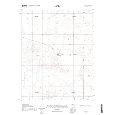
2018 Map of Rosston
USGS Topo · Published 2018About this map
Rosston sits at the intersection of local routes in this modern survey of Harper County, where the high plains landscape is defined by the winding course of the Beaver River. The riverbed, along with smaller drainage systems like Redoubt Cr and Kiowa Cr, cuts through a grid of section lines and rural roads such as N1760 Rd. This modern topographical study captures the organized agricultural and residential layout of the region as it existed in the late 2010s. For those looking at local history or genealogy, the map identifies the Pleasant Ridge Cem in the northeastern corner, a key landmark for tracing family roots in the area. Further south, the Laverne Municipal Airport serves as a modern transportation hub, contrasting with the long-standing street plan of Rosston which includes Wilson St, Beaver St, and D St.
Find a feature on this map
31 named features on this map. Tap any name to fly to it.
Don’t see what you’re looking for? This feature index may not catch every label — zoom into the map to look around manually.
Map Details
Editions of this 2018 Rosston Map
This is the sole edition of this map. No revisions or reprints were ever made.
Other maps of this area

1954 · Perryton
USGS Topo · 1:250,000

1955 · Woodward
USGS Topo · 1:250,000

1958 · Perryton
USGS Topo · 1:250,000

1958 · Woodward
USGS Topo · 1:250,000

1970 · Gate
USGS Topo · 1:24,000
1970 · Gate NE
USGS Topo · 1:24,000
1970 · Rosston NW
USGS Topo · 1:24,000

1970 · Rosston NE
USGS Topo · 1:24,000

1971 · Rosston SE
USGS Topo · 1:24,000

1971 · Rosston
USGS Topo · 1:24,000