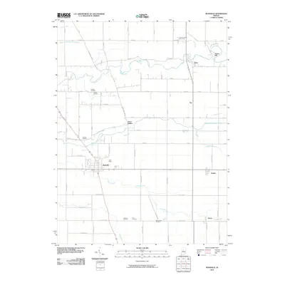
2010 Map of Rossville
USGS Topo · Published 2010About this map
Wildcat Creek and its southern branch, Middle Fork Wildcat Creek, define the drainage and settlement patterns of this Indiana landscape. The town of Rossville serves as the primary hub, situated near Gray Field and the winding course of Campbells Run. The geography is dotted with evidence of early settler life, from the scattered pioneer cemeteries like Hufford Cemetery and Hughes Cemetery to the notable Adams Mill located along the creek near Cutler. Smaller hamlets such as Prince William, Sedalia, and Moran are connected by a rigorous grid of section-line roads, illustrating the systematic agricultural development typical of Clinton County. Significant water infrastructure is noted at the Vernon Payne Lake Dam, while numerous family-named burial grounds like Mount Hope Cemetery, Latshaw Cemetery, and Hiner Cemetery provide valuable geographic markers for genealogical research in this rural corridor.
Find a feature on this map
62 named features on this map. Tap any name to fly to it.
Don’t see what you’re looking for? This feature index may not catch every label — zoom into the map to look around manually.
Map Details
Editions of this 2010 Rossville Map
This is the sole edition of this map. No revisions or reprints were ever made.
Other maps of this area

1953 · Danville
USGS Topo · 1:250,000

1955 · Danville
USGS Topo · 1:250,000

1956 · Danville
USGS Topo · 1:250,000

1961 · Michigantown
USGS Topo · 1:24,000

1961 · Mulberry
USGS Topo · 1:24,000

1961 · Pyrmont
USGS Topo · 1:24,000

1961 · Rossville
USGS Topo · 1:24,000

1961 · Burlington
USGS Topo · 1:24,000

1961 · Frankfort
USGS Topo · 1:24,000

1962 · Deer Creek
USGS Topo · 1:24,000