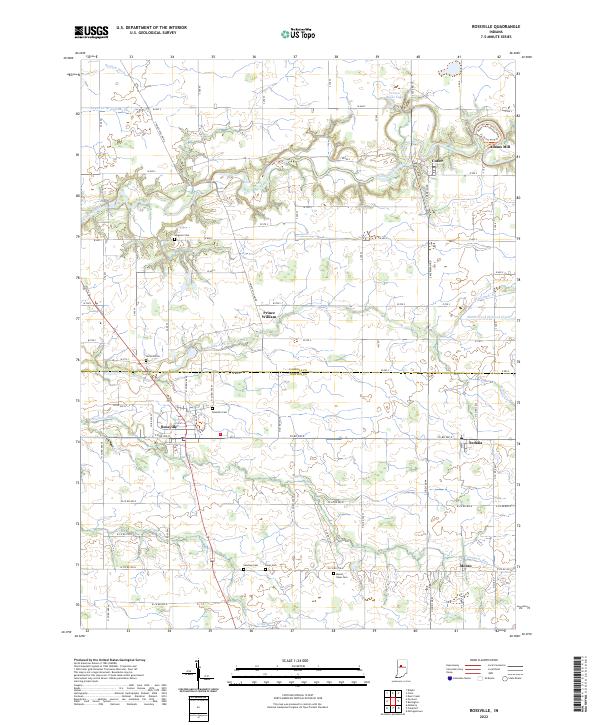
2022 Map of Rossville
USGS Topo · Published 2022About this map
Wildcat Creek and its southern tributaries, Middle Fork Wildcat Creek and Campbells Run, carve through the agricultural landscape of this Indiana region. The area is anchored by several long-established rural settlements, including Rossville, Sedalia, and Cutler, which serve as local hubs for the surrounding farmsteads. A significant historical landmark is Adams Mill, situated near the Adam's Mill Oxbow Nature Trail in the northeastern quadrant, highlighting the region's early milling heritage along the waterways.
Find a feature on this map
83 named features on this map. Tap any name to fly to it.
Don’t see what you’re looking for? This feature index may not catch every label — zoom into the map to look around manually.
Map Details
Editions of this 2022 Rossville Map
This is the sole edition of this map. No revisions or reprints were ever made.
Other maps of this area

1953 · Danville
USGS Topo · 1:250,000

1955 · Danville
USGS Topo · 1:250,000

1956 · Danville
USGS Topo · 1:250,000

1961 · Michigantown
USGS Topo · 1:24,000

1961 · Mulberry
USGS Topo · 1:24,000

1961 · Pyrmont
USGS Topo · 1:24,000

1961 · Rossville
USGS Topo · 1:24,000

1961 · Burlington
USGS Topo · 1:24,000

1961 · Frankfort
USGS Topo · 1:24,000

1962 · Deer Creek
USGS Topo · 1:24,000