
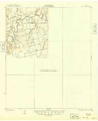
1931 Map of Rotan
USGS Topo · Published 1931About this map
The Brazos River carves a winding path through the northern portion of this 1931 survey, forming a distinct oxbow at Bullock Bend. This landscape marks the rugged transition across the Stonewall and Fisher County line, where the terrain is dominated by deep drainage patterns and the Clear Fork of the river. The map illustrates a rural Texas community structured around small local institutions and early regional transit routes. Settlements here are anchored by locations like Dowell Ch and educational centers including Dorras Sch and Dowell Sch. Transportation in the early twentieth century is defined by the Canadian Highway No 70 and the Del Rio Highway, providing a look at the infrastructure that connected these remote ranching and farming districts before modern highway developments altered the local geography.
Find a feature on this map
10 named features on this map. Tap any name to fly to it.
Don’t see what you’re looking for? This feature index may not catch every label — zoom into the map to look around manually.
Map Details
Editions of this 1931 Rotan Map
2 editions found
Other maps of this area

1893 · Roby
USGS Topo · 1:125,000

1926 · Snyder 1-a
USGS Topo · 1:48,000

1926 · Roby 2-b
USGS Topo · 1:48,000

1931 · Aspermont
USGS Topo · 1:62,500

1932 · Camp Springs
USGS Topo · 1:62,500

1954 · Lubbock
USGS Topo · 1:250,000

1954 · Big Spring
USGS Topo · 1:250,000

1957 · Noodle
USGS Topo · 1:62,500

1958 · Big Spring
USGS Topo · 1:250,000
1965 · Hamlin NW
USGS Topo · 1:24,000