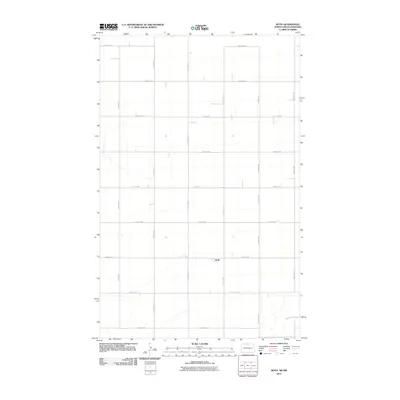
2011 Map of Roth
USGS Topo · Published 2011About this map
Roth sits at the heart of this Bottineau County landscape, a small settlement defined by its position within the expansive agricultural grid of the North Dakota prairie. The terrain is structured by a network of sectional roads, including 109th St NW and 8th Ave NW, which carve the land into precise rectangles. A rare departure from this geometric regularity is found in the southeast, where Boundary Creek meanders toward the border. This 2011 survey, produced by the U.S. Geological Survey, illustrates the enduring rural character of the region. Local connectivity is maintained by routes like County Rd 33, reflecting a landscape dedicated to large-scale farming where the vast distance between homesteads is bridged by a system of gravel and paved roads.
Find a feature on this map
19 named features on this map. Tap any name to fly to it.
Don’t see what you’re looking for? This feature index may not catch every label — zoom into the map to look around manually.
Map Details
Editions of this 2011 Roth Map
This is the sole edition of this map. No revisions or reprints were ever made.
Other maps of this area

1949 · Landa
USGS Topo · 1:24,000

1949 · Landa SW
USGS Topo · 1:24,000

1950 · Landa
USGS Topo · 1:24,000

1950 · Landa SW
USGS Topo · 1:24,000

1954 · Souris SW
USGS Topo · 1:24,000

1954 · Landa SE
USGS Topo · 1:24,000

1954 · Souris
USGS Topo · 1:24,000

1954 · Roth
USGS Topo · 1:24,000

1954 · Minot
USGS Topo · 1:250,000

1958 · Minot
USGS Topo · 1:250,000