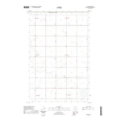
2020 Map of Roth
USGS Topo · Published 2020About this map
Roth anchors this North Dakota landscape in Bottineau County, situated just south of the international border with the United States of America. The area is defined by a grid of rural section lines and township boundaries, including t163n r78w and t164n r78w, which organize the expansive agricultural terrain. Water features are sparse but significant, notably Boundary Cr flowing through the southeastern corner of the quadrangle. For those researching local family history, the Lesje Cem is a prominent landmark located along 107th St NW, serving as a silent record of the early settlers who established this prairie community. The map details a network of secondary roads such as Co Rd 27A and numerous numbered routes like 104th St NW, reflecting the systematic development of the region's transportation infrastructure for farming and local commerce.
Find a feature on this map
21 named features on this map. Tap any name to fly to it.
Don’t see what you’re looking for? This feature index may not catch every label — zoom into the map to look around manually.
Map Details
Editions of this 2020 Roth Map
This is the sole edition of this map. No revisions or reprints were ever made.
Other maps of this area

1949 · Landa
USGS Topo · 1:24,000

1949 · Landa SW
USGS Topo · 1:24,000

1950 · Landa
USGS Topo · 1:24,000

1950 · Landa SW
USGS Topo · 1:24,000

1954 · Souris SW
USGS Topo · 1:24,000

1954 · Landa SE
USGS Topo · 1:24,000

1954 · Souris
USGS Topo · 1:24,000

1954 · Roth
USGS Topo · 1:24,000

1954 · Minot
USGS Topo · 1:250,000

1958 · Minot
USGS Topo · 1:250,000