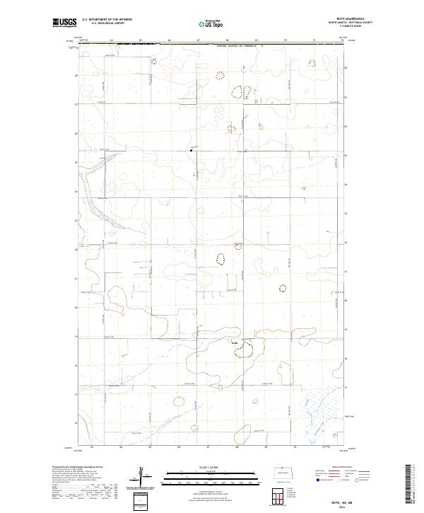
2024 Map of Roth
USGS Topo · Published 2024About this map
United States of America's northern border defines the upper edge of this prairie landscape in Bottineau County. The map is centered on the small settlement of Roth, situated along the intersection of 103rd St NW and 4th Ave NW. The survey reflects a strictly organized township and range system, where a network of section-line roads like 5th Ave NW and 107th St NW segment the terrain into precise agricultural blocks. Genealogy researchers will find the Lesje Cem located along the northern reach of 5th Ave NW. In the southeastern portion of the quadrangle, the conservation efforts of the Bottineau County Waterfowl Production Area protect the riparian corridor surrounding Boundary Creek, where the geometric road grid gives way to natural wetlands and drainage patterns.
Find a feature on this map
26 named features on this map. Tap any name to fly to it.
Don’t see what you’re looking for? This feature index may not catch every label — zoom into the map to look around manually.
Map Details
Editions of this 2024 Roth Map
This is the sole edition of this map. No revisions or reprints were ever made.
Other maps of this area

1949 · Landa
USGS Topo · 1:24,000

1949 · Landa SW
USGS Topo · 1:24,000

1950 · Landa
USGS Topo · 1:24,000

1950 · Landa SW
USGS Topo · 1:24,000

1954 · Souris SW
USGS Topo · 1:24,000

1954 · Landa SE
USGS Topo · 1:24,000

1954 · Souris
USGS Topo · 1:24,000

1954 · Roth
USGS Topo · 1:24,000

1954 · Minot
USGS Topo · 1:250,000

1958 · Minot
USGS Topo · 1:250,000