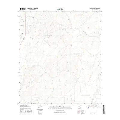
2016 Map of Rough Canyon SE
USGS Topo · Published 2016About this map
Rough Canyon and the surrounding rangeland of Val Verde County are defined by a complex network of ephemeral drainages and ranch corridors. This 2016 survey shows a landscape dominated by the headwaters and branches of the San Pedro Cr system, including the N Fork San Pedro Cr, alongside the upper reaches of Sycamore Cr. The map highlights the enduring presence of large-scale landholdings through named access routes such as Gillis Ranch Rd, Lewis Ranch Rd, and Gurley Mcbee Rd. While most of the terrain is arid, the inclusion of Moody Lake offers a distinct point of interest in an otherwise dry topographical profile. Modern infrastructure is represented by St Recreational Rd 2 and Rio Diablo Rd, providing access to the more remote sections of this Edwards Plateau transition zone.
Find a feature on this map
11 named features on this map. Tap any name to fly to it.
Don’t see what you’re looking for? This feature index may not catch every label — zoom into the map to look around manually.
Map Details
Editions of this 2016 Rough Canyon SE Map
This is the sole edition of this map. No revisions or reprints were ever made.
Other maps of this area

1941 · Standart
USGS Topo · 1:62,500

1943 · Standart
USGS Topo · 1:62,500

1943 · Del Rio
USGS Topo · 1:62,500

1944 · Flat Rock
USGS Topo · 1:62,500

1944 · Devils Lake
USGS Topo · 1:62,500

1958 · Del Rio
USGS Topo · 1:250,000

1964 · Del Rio
USGS Topo · 1:250,000

1972 · Miers Ranch
USGS Topo · 1:24,000

1972 · Rough Canyon SE
USGS Topo · 1:24,000
1972 · Del Rio NW
USGS Topo · 1:24,000