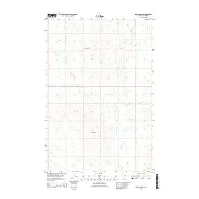
2014 Map of Rough Creek SW
USGS Topo · Published 2014About this map
Little Porcupine Creek and its many tributaries carve a network of drainages across this portion of Rosebud County, defining a landscape marked by elevation changes from 2600 to over 3000 feet. This 2014 survey captures a section of the eastern Montana plains where land management is organized by the Public Land Survey System, specifically within t10n r40e and t9n r40e. The map highlights the intricate hydrological patterns of the region, from the winding path of Rattlesnake Creek in the west to the headwaters of Wolf Creek and Cottonwood Creek in the east. Stellar Creek crosses the southwestern corner, illustrating the importance of these watercourses in an otherwise arid grazing and ranching environment. For researchers, the map provides precise section-line boundaries and topography used to locate property and land use in this sparsely populated interior.
Find a feature on this map
8 named features on this map. Tap any name to fly to it.
Don’t see what you’re looking for? This feature index may not catch every label — zoom into the map to look around manually.
Map Details
Editions of this 2014 Rough Creek SW Map
This is the sole edition of this map. No revisions or reprints were ever made.
Other maps of this area

1954 · Forsyth
USGS Topo · 1:250,000

1957 · Forsyth
USGS Topo · 1:250,000

1958 · Forsyth
USGS Topo · 1:250,000

1968 · Schultz Coulee
USGS Topo · 1:24,000

1968 · Finch NE
USGS Topo · 1:24,000

1968 · Black Coulee
USGS Topo · 1:24,000

1969 · Rudie Coulee
USGS Topo · 1:24,000

1969 · Flat Bottom Coulee NE
USGS Topo · 1:24,000
1969 · Rough Creek SE
USGS Topo · 1:24,000
1969 · Rough Creek SW
USGS Topo · 1:24,000