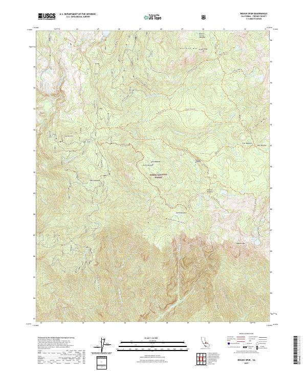
2021 Map of Rough Spur
USGS Topo · Published 2021About this map
The Sierra National Forest dominates this high-altitude landscape in Fresno County, where the Middle Fork Kings River carves through the dramatic Granite Gorge. This section of the Sierra Nevada is defined by significant ridges and peaks, including Spanish Mtn and Hoffman Mtn, which frame a network of alpine basins. An extensive trail system, including the Woodchuck Trl and Crown Valley Trl, connects various mountain meadows like Statham Meadow and Round Corral Meadow.
Find a feature on this map
56 named features on this map. Tap any name to fly to it.
Don’t see what you’re looking for? This feature index may not catch every label — zoom into the map to look around manually.
Map Details
Editions of this 2021 Rough Spur Map
This is the sole edition of this map. No revisions or reprints were ever made.
Other maps of this area

1903 · Tehipite
USGS Topo · 1:125,000

1904 · Kaiser
USGS Topo · 1:125,000

1905 · Tehipite
USGS Topo · 1:125,000

1912 · Mt. Goddard
USGS Topo · 1:125,000

1922 · Trimmer
USGS Topo · 1:96,000

1924 · Dinuba
USGS Topo · 1:125,000

1947 · Mariposa
USGS Topo · 1:250,000

1948 · Fresno
USGS Topo · 1:250,000

1948 · Mariposa
USGS Topo · 1:250,000

1952 · Tehipite Dome
USGS Topo · 1:62,500