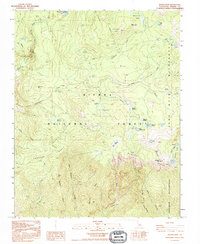
1992 Map of Rough Spur
USGS Topo · Published 1994About this map
Wishon Reservoir and the North Fork Kings River define the northern hydrology of this high-elevation terrain, where water management and wilderness preservation meet. The landscape is characterized by its transition from the managed resources of the Sierra National Forest into the protected expanses of the John Muir Wilderness and Monarch Wilderness. A Pack Station and Cliff Camp near the reservoir indicate a history of seasonal recreation and backcountry access typical of the late twentieth century in the High Sierra. Significant topographical markers like Hoffman Mtn and the steep contours of Rodgers Ridge divide the drainage basins of Rancheria Creek and Garlic Meadow Creek. High-country lakes, including Spanish Lake and the Geraldine Lakes, are scattered across the eastern granite basins, providing a detailed record of the region's glacial geography.
Find a feature on this map
37 named features on this map. Tap any name to fly to it.
Don’t see what you’re looking for? This feature index may not catch every label — zoom into the map to look around manually.
Map Details
Editions of this 1992 Rough Spur Map
This is the sole edition of this map. No revisions or reprints were ever made.
Other maps of this area

1903 · Tehipite
USGS Topo · 1:125,000

1904 · Kaiser
USGS Topo · 1:125,000

1905 · Tehipite
USGS Topo · 1:125,000

1912 · Mt. Goddard
USGS Topo · 1:125,000

1922 · Trimmer
USGS Topo · 1:96,000

1924 · Dinuba
USGS Topo · 1:125,000

1947 · Mariposa
USGS Topo · 1:250,000

1948 · Fresno
USGS Topo · 1:250,000

1948 · Mariposa
USGS Topo · 1:250,000

1952 · Tehipite Dome
USGS Topo · 1:62,500