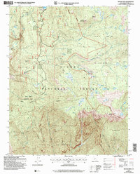
2004 Map of Rough Spur
USGS Topo · Published 2007About this map
Wishon Reservoir and the North Fork Kings River anchor this high-elevation landscape within the Sierra National Forest. The map documents a rugged interior network of meadows and peaks, including Hoffman Mountain and Finger Rock, where forest management and wilderness preservation meet. Traces of human activity are concentrated near the reservoir at the Wishon Work Center and Cliff Camp, alongside infrastructure like a Pack Station and Gaging Station.
Find a feature on this map
49 named features on this map. Tap any name to fly to it.
Don’t see what you’re looking for? This feature index may not catch every label — zoom into the map to look around manually.
Map Details
Editions of this 2004 Rough Spur Map
This is the sole edition of this map. No revisions or reprints were ever made.
Other maps of this area

1903 · Tehipite
USGS Topo · 1:125,000

1904 · Kaiser
USGS Topo · 1:125,000

1905 · Tehipite
USGS Topo · 1:125,000

1912 · Mt. Goddard
USGS Topo · 1:125,000

1922 · Trimmer
USGS Topo · 1:96,000

1924 · Dinuba
USGS Topo · 1:125,000

1947 · Mariposa
USGS Topo · 1:250,000

1948 · Fresno
USGS Topo · 1:250,000

1948 · Mariposa
USGS Topo · 1:250,000

1952 · Tehipite Dome
USGS Topo · 1:62,500