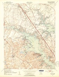
1949 Map of Round Bay
USGS Topo · Published 1953About this map
Severna Park and its surrounding communities along the Severn River reflect the mid-century suburbanization of Anne Arundel County. The landscape is defined by its deep relationship with the water, as seen in the dense cluster of shoreline developments like Herald Harbor, Sherwood Forest, and Manhattan Beach. Inland, the Governor Ritchie Highway serves as the primary artery, cutting through settlements such as Pasadena and Robinson. This era captures the transition of the region from rural landholdings like Belvoir Manor and Carrollton Manor into a series of residential enclaves.
Find a feature on this map
108 named features on this map. Tap any name to fly to it.
Don’t see what you’re looking for? This feature index may not catch every label — zoom into the map to look around manually.
Map Details
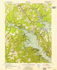
Editions of this 1949 Round Bay Map
2 editions found
Other maps of this area

1892 · Owensville
USGS Topo · 1:62,500

1892 · Annapolis
USGS Topo · 1:62,500

1893 · North Point
USGS Topo · 1:62,500

1894 · Relay
USGS Topo · 1:62,500

1895 · Owensville
USGS Topo · 1:62,500

1898 · Choptank
USGS Topo · 1:125,000

1898 · Tolchester
USGS Topo · 1:125,000

1899 · Patuxent
USGS Topo · 1:125,000

1903 · Tolchester
USGS Topo · 1:125,000

1904 · North Point
USGS Topo · 1:62,500