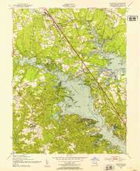
1949 Map of Round Bay
USGS Topo · Published 1953About this map
The Severn River and Magothy River define this mid-century landscape of Anne Arundel County, where suburban development began to intersect with established waterfront estates. The Baltimore and Annapolis RR runs through the center of the sheet, connecting towns like Severna Park and Pasadena. This transit corridor, flanked by the Annapolis and Baltimore Ritchie Highway, facilitated the growth of communities like Carrollton Manor and Herald Harbor.
Find a feature on this map
102 named features on this map. Tap any name to fly to it.
Don’t see what you’re looking for? This feature index may not catch every label — zoom into the map to look around manually.
Map Details
Editions of this 1949 Round Bay Map
2 editions found
Other maps of this area

1892 · Owensville
USGS Topo · 1:62,500

1892 · Annapolis
USGS Topo · 1:62,500

1893 · North Point
USGS Topo · 1:62,500

1894 · Relay
USGS Topo · 1:62,500

1895 · Owensville
USGS Topo · 1:62,500

1898 · Choptank
USGS Topo · 1:125,000

1898 · Tolchester
USGS Topo · 1:125,000

1899 · Patuxent
USGS Topo · 1:125,000

1903 · Tolchester
USGS Topo · 1:125,000

1904 · North Point
USGS Topo · 1:62,500