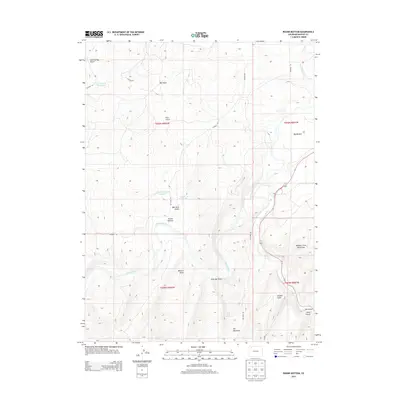
2013 Map of Round Bottom
USGS Topo · Published 2013About this map
The Yampa River meanders across this landscape in northwestern Colorado, defining the valley between high plateaus and peaks. This 2013 survey records a region where cattle ranching and energy extraction intersect, evidenced by the network of rural routes like Coal Mine Rd and CO Road 30. Water management is central to life here, with Culverwell Reservoir and Ellgen Reservoir providing vital storage in a land carved by deep drainages such as Sand Spring Gulch and Ralston Draw. To the southeast, the terrain rises sharply toward the Williams Fork Mountains and Iles Mountain, while the confluence of the Williams Fork and the Yampa marks a significant hydrologic junction near Big Bottom. Local family history and land use are reflected in place names like Bell Rock and the namesake Round Bottom valley.
Find a feature on this map
32 named features on this map. Tap any name to fly to it.
Don’t see what you’re looking for? This feature index may not catch every label — zoom into the map to look around manually.
Map Details
Editions of this 2013 Round Bottom Map
This is the sole edition of this map. No revisions or reprints were ever made.
Other maps of this area

1910 · Danforth Hills
USGS Topo · 1:125,000

1912 · Axial
USGS Topo · 1:62,500

1914 · Axial
USGS Topo · 1:62,500

1915 · Monument Butte
USGS Topo · 1:62,500

1916 · Craig
USGS Topo · 1:125,000

1954 · Craig
USGS Topo · 1:250,000

1957 · Craig
USGS Topo · 1:250,000

1958 · Craig
USGS Topo · 1:250,000

1960 · Craig
USGS Topo · 1:250,000

1962 · Craig
USGS Topo · 1:250,000