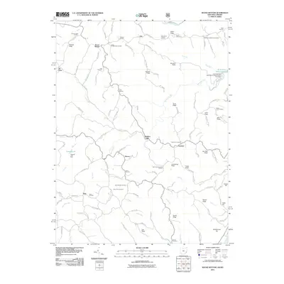
2011 Map of Round Bottom
USGS Topo · Published 2011About this map
Winklers Mill and the surrounding ridgetops of Monroe County define this portion of the Ohio River valley as seen in 2011. The landscape is characterized by a dense network of family and community landmarks, particularly evident in the high concentration of burial grounds such as Chapel Hill Methodist Cemetery, Mount Sinai Methodist Cemetery, and Saint Johns Methodist Cemetery. These sites, alongside family-named plots like Kraft Cemetery and Fuchs Cemetery, provide a detailed record of local settlement history across the township.
Find a feature on this map
116 named features on this map. Tap any name to fly to it.
Don’t see what you’re looking for? This feature index may not catch every label — zoom into the map to look around manually.
Map Details
Editions of this 2011 Round Bottom Map
This is the sole edition of this map. No revisions or reprints were ever made.
Other maps of this area

1905 · Clarington
USGS Topo · 1:62,500

1905 · New Matamoras
USGS Topo · 1:62,500

1905 · Woodsfield
USGS Topo · 1:62,500

1906 · New Martinsville
USGS Topo · 1:62,500

1924 · New Martinsville
USGS Topo · 1:62,500

1924 · New Matamoras
USGS Topo · 1:62,500

1926 · New Martinsville
USGS Topo · 1:62,500

1926 · New Matamoras
USGS Topo · 1:62,500

1935 · Clarington
USGS Topo · 1:62,500

1940 · Clarington
USGS Topo · 1:62,500