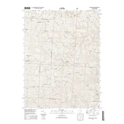
2013 Map of Round Bottom
USGS Topo · Published 2013About this map
The Ohio River forms the eastern boundary of this region in Monroe County, defining the transport and settlement patterns of riverside towns like Hannibal and Sardis. Moving inland, the landscape is characterized by a dense network of ridges such as Tisher Ridge, Baptist Ridge, and Pleasant Ridge, many of which host long-standing community landmarks. The map reveals a high concentration of historic religious and burial sites, including the Saint James Lutheran Cem, Mt Sinai Methodist Cem, and the Mt Zion Cem, reflecting the deep-rooted genealogical heritage of Green Township. Portions of the Wayne National Forest cover the western terrain, where smaller settlements like Round Bottom and Morton are connected by winding routes such as State Rte 536 and Oh-255. Evidence of early industrial and agricultural activity persists in names like Winklers Mill and Dairy, while the rugged creek valleys of Sunfish Creek and Cranenest Fork dictate the area's geography.
Find a feature on this map
108 named features on this map. Tap any name to fly to it.
Don’t see what you’re looking for? This feature index may not catch every label — zoom into the map to look around manually.
Map Details
Editions of this 2013 Round Bottom Map
This is the sole edition of this map. No revisions or reprints were ever made.
Other maps of this area

1905 · Clarington
USGS Topo · 1:62,500

1905 · New Matamoras
USGS Topo · 1:62,500

1905 · Woodsfield
USGS Topo · 1:62,500

1906 · New Martinsville
USGS Topo · 1:62,500

1924 · New Martinsville
USGS Topo · 1:62,500

1924 · New Matamoras
USGS Topo · 1:62,500

1926 · New Martinsville
USGS Topo · 1:62,500

1926 · New Matamoras
USGS Topo · 1:62,500

1935 · Clarington
USGS Topo · 1:62,500

1940 · Clarington
USGS Topo · 1:62,500