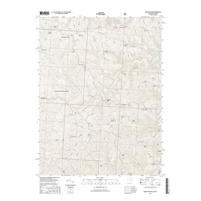
2016 Map of Round Bottom
USGS Topo · Published 2016About this map
Beautiful Ridge and Hannibal Ridge define the undulating landscape of eastern Monroe County, where the hills descend toward the Ohio River. This 2016 survey shows a territory deeply rooted in agricultural and Methodist history, evidenced by a dense distribution of rural burial grounds such as Chapel Hill Methodist Cem and Saint Johns Methodist Cem. The small settlements of Sardis and Duffy occupy the riverbank, while the interior is dotted with historic locales like Winklers Mill and Round Bottom. These names, alongside family-identified landforms like Tisher Ridge and Harmon Ridge, speak to generations of local settlement patterns. A notable portion of the western terrain is preserved within the Wayne National Forest, contrasting with the industrial presence of Slurry Impoundments 3, 3a, 3b near the river, illustrating the complex intersection of public land management and local industry in modern Ohio.
Find a feature on this map
131 named features on this map. Tap any name to fly to it.
Don’t see what you’re looking for? This feature index may not catch every label — zoom into the map to look around manually.
Map Details
Editions of this 2016 Round Bottom Map
This is the sole edition of this map. No revisions or reprints were ever made.
Other maps of this area

1905 · Clarington
USGS Topo · 1:62,500

1905 · New Matamoras
USGS Topo · 1:62,500

1905 · Woodsfield
USGS Topo · 1:62,500

1906 · New Martinsville
USGS Topo · 1:62,500

1924 · New Martinsville
USGS Topo · 1:62,500

1924 · New Matamoras
USGS Topo · 1:62,500

1926 · New Martinsville
USGS Topo · 1:62,500

1926 · New Matamoras
USGS Topo · 1:62,500

1935 · Clarington
USGS Topo · 1:62,500

1940 · Clarington
USGS Topo · 1:62,500