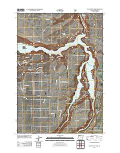
2011 Map of Round Butte Dam
USGS Topo · Published 2011About this map
Lake Billy Chinook dominates this high desert landscape, formed at the confluence of several major drainages. The Round Butte Dam and its associated Dam Observatory manage these waters, creating a massive reservoir that fills the deep gorges of Metolius Canyon and Deschutes Canyon. These canyons carve around prominent landforms like The Island and The Peninsula, illustrating the dramatic verticality of the Central Oregon plateau.
Find a feature on this map
40 named features on this map. Tap any name to fly to it.
Don’t see what you’re looking for? This feature index may not catch every label — zoom into the map to look around manually.
Map Details
Editions of this 2011 Round Butte Dam Map
This is the sole edition of this map. No revisions or reprints were ever made.
Other maps of this area

1926 · Bend
USGS Topo · 1:125,000

1928 · Madras
USGS Topo · 1:125,000

1929 · Bend
USGS Topo · 1:125,000

1931 · Madras
USGS Topo · 1:125,000

1955 · Bend
USGS Topo · 1:250,000

1957 · Bend
USGS Topo · 1:250,000

1958 · Bend
USGS Topo · 1:250,000

1962 · Metolius Bench
USGS Topo · 1:24,000

1962 · Opal City
USGS Topo · 1:24,000

1962 · Fly Creek
USGS Topo · 1:24,000