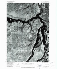
1976 Map of Round Butte Dam
USGS Topo · Published 1981About this map
Round Butte Dam stands at the heart of this orthophotoquad, anchoring the confluence of major high-desert waterways. Produced in cooperation with the Bureau of Indian Affairs, this 1976 aerial survey provides a photographic look at the complex geometry where the Deschutes River, Metolius River Lake Chinook, and Crooked River converge. The imagery reveals the steep canyon walls and the expansive reaches of Lake Chinook, illustrating how the massive hydroelectric project transformed the landscape of Jefferson County. This perspective captures the engineered shoreline and the surrounding arid terrain during the mid-1970s, offering researchers a visual record of the dam's footprint and the resulting reservoir system before later recreational developments and local land-use changes.
Find a feature on this map
5 named features on this map. Tap any name to fly to it.
Don’t see what you’re looking for? This feature index may not catch every label — zoom into the map to look around manually.
Map Details
Editions of this 1976 Round Butte Dam Map
This is the sole edition of this map. No revisions or reprints were ever made.
Other maps of this area

1926 · Bend
USGS Topo · 1:125,000

1928 · Madras
USGS Topo · 1:125,000

1929 · Bend
USGS Topo · 1:125,000

1931 · Madras
USGS Topo · 1:125,000

1955 · Bend
USGS Topo · 1:250,000

1957 · Bend
USGS Topo · 1:250,000

1958 · Bend
USGS Topo · 1:250,000

1962 · Metolius Bench
USGS Topo · 1:24,000

1962 · Opal City
USGS Topo · 1:24,000

1962 · Fly Creek
USGS Topo · 1:24,000