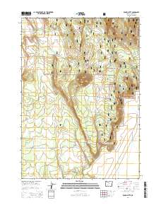
2014 Map of Round Butte
USGS Topo · Published 2014About this map
Winema National Forest encompasses the entirety of this landscape in southern Oregon, where the terrain is defined by volcanic elevations and seasonal water sources. The namesake Round Butte sits near the center of the sheet, while String Butte rises to the north, overlooking a network of drainage systems including Shoestring Cr and Cole Cr. This high-elevation area is marked by several vital water points such as Willow Spring, Log Spring, and Tank Spring, which historically supported movement through these woods.
Find a feature on this map
30 named features on this map. Tap any name to fly to it.
Don’t see what you’re looking for? This feature index may not catch every label — zoom into the map to look around manually.
Map Details
Editions of this 2014 Round Butte Map
This is the sole edition of this map. No revisions or reprints were ever made.
Other maps of this area

1889 · Klamath
USGS Topo · 1:250,000

1894 · Klamath
USGS Topo · 1:250,000

1935 · Chemult
USGS Topo · 1:96,000

1941 · Chemult
USGS Topo · 1:125,000

1955 · Crescent
USGS Topo · 1:250,000

1955 · Klamath Falls
USGS Topo · 1:250,000

1957 · Crescent
USGS Topo · 1:250,000

1957 · Klamath Marsh
USGS Topo · 1:62,500

1957 · Lenz
USGS Topo · 1:62,500

1958 · Crescent
USGS Topo · 1:250,000