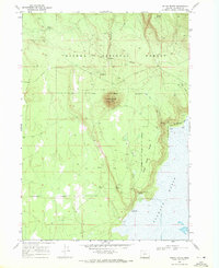
1968 Map of Round Butte
USGS Topo · Published 1972About this map
Winema National Forest land dominates this high-altitude landscape, where the volcanic topography is defined by prominent peaks like Round Butte and String Butte. The 1968 survey reveals a terrain shaped by both historic administrative lines and practical cattle ranching, most notably the Old Indian Treaty Boundary cutting across the northern sections and the Old Railroad Grade tracing the lower slopes near the water's edge.
Find a feature on this map
20 named features on this map. Tap any name to fly to it.
Don’t see what you’re looking for? This feature index may not catch every label — zoom into the map to look around manually.
Map Details
Editions of this 1968 Round Butte Map
This is the sole edition of this map. No revisions or reprints were ever made.
Other maps of this area

1889 · Klamath
USGS Topo · 1:250,000

1894 · Klamath
USGS Topo · 1:250,000

1935 · Chemult
USGS Topo · 1:96,000

1941 · Chemult
USGS Topo · 1:125,000

1955 · Crescent
USGS Topo · 1:250,000

1955 · Klamath Falls
USGS Topo · 1:250,000

1957 · Crescent
USGS Topo · 1:250,000

1957 · Klamath Marsh
USGS Topo · 1:62,500

1957 · Lenz
USGS Topo · 1:62,500

1958 · Crescent
USGS Topo · 1:250,000