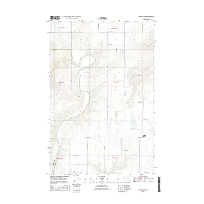
2017 Map of Round Butte
USGS Topo · Published 2017About this map
The Flathead River defines the western reaches of this landscape, carving a wide arc through the valley floor before crossing the Lake County and Sanders County line. This 2017 survey reveals an intricate irrigation network essential to the region's agricultural character, including the Pablo A Canal, Pablo 70A Canal, and the Pablo 73A14 Ditch. These waterways feed into landmarks like the Horte Reservoir near the small settlement of Round Butte.
Find a feature on this map
35 named features on this map. Tap any name to fly to it.
Don’t see what you’re looking for? This feature index may not catch every label — zoom into the map to look around manually.
Map Details
Editions of this 2017 Round Butte Map
This is the sole edition of this map. No revisions or reprints were ever made.
Other maps of this area

1920 · Flathead Lake
USGS Topo · 1:125,000

1956 · Wallace
USGS Topo · 1:250,000

1960 · Wallace
USGS Topo · 1:250,000

1964 · Buffalo Bridge
USGS Topo · 1:24,000

1964 · Melton Ranch
USGS Topo · 1:24,000

1964 · Polson
USGS Topo · 1:24,000

1964 · Lower Crow Reservoir
USGS Topo · 1:24,000

1965 · Sloan
USGS Topo · 1:24,000

1965 · Oliver Point
USGS Topo · 1:24,000
1965 · Irvine Hill
USGS Topo · 1:24,000