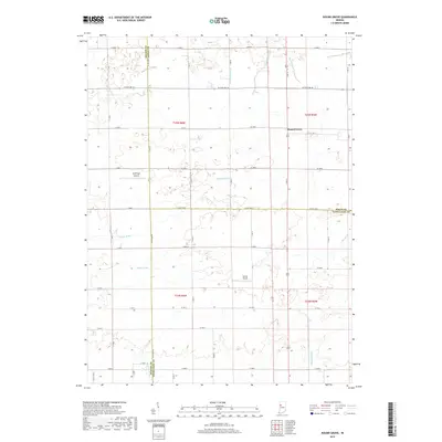
2019 Map of Round Grove
USGS Topo · Published 2019About this map
Round Grove stands as the primary community in this rural Indiana landscape, which transitions across three county boundaries including Benton, White, and Tippecanoe. The terrain is defined by a sophisticated network of agricultural drainage, evidenced by named waterways like Vanatta Ditch, Roudebush Ditch, and Brumm Ditch that feed into larger natural systems such as Big Pine Creek. This 2019 survey illustrates the modern layout of sections and range lines, particularly in T25N R6W and T24N R5W, where the land is primarily organized for farming. Local aviation is represented by Durflinger Airport and Sutton Airport, providing specific landmarks for those tracing the development of regional infrastructure and land use in this part of the Wabash River watershed.
Find a feature on this map
42 named features on this map. Tap any name to fly to it.
Don’t see what you’re looking for? This feature index may not catch every label — zoom into the map to look around manually.
Map Details
Editions of this 2019 Round Grove Map
This is the sole edition of this map. No revisions or reprints were ever made.
Other maps of this area

1941 · Lafayette
USGS Topo · 1:24,000

1942 · Otterbein
USGS Topo · 1:24,000

1942 · Lafayette
USGS Topo · 1:24,000

1950 · Lafayette
USGS Topo · 1:24,000

1951 · Otterbein
USGS Topo · 1:24,000

1953 · Danville
USGS Topo · 1:250,000

1955 · Danville
USGS Topo · 1:250,000

1956 · Danville
USGS Topo · 1:250,000

1961 · Chatterton
USGS Topo · 1:24,000

1961 · Otterbein
USGS Topo · 1:24,000