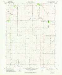
1962 Map of Round Grove
USGS Topo · Published 1963About this map
The agricultural landscape of Benton, White, and Tippecanoe counties is defined by an extensive network of drainage infrastructure. This mid-century survey illustrates how the prairies of Pine and Round Grove townships were managed through a system of engineered waterways like Roudebush Ditch, Brumm Ditch, and Otterbein Ditch. These man-made channels support the natural flow of Little Pine Creek and Big Pine Creek, reflecting the region's intensive land reclamation for farming.
Find a feature on this map
36 named features on this map. Tap any name to fly to it.
Don’t see what you’re looking for? This feature index may not catch every label — zoom into the map to look around manually.
Map Details
Editions of this 1962 Round Grove Map
This is the sole edition of this map. No revisions or reprints were ever made.
Other maps of this area

1941 · Lafayette
USGS Topo · 1:24,000

1942 · Otterbein
USGS Topo · 1:24,000

1942 · Lafayette
USGS Topo · 1:24,000

1950 · Lafayette
USGS Topo · 1:24,000

1951 · Otterbein
USGS Topo · 1:24,000

1953 · Danville
USGS Topo · 1:250,000

1955 · Danville
USGS Topo · 1:250,000

1956 · Danville
USGS Topo · 1:250,000

1961 · Chatterton
USGS Topo · 1:24,000

1961 · Otterbein
USGS Topo · 1:24,000