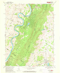
1970 Map of Round Hill
USGS Topo · Published 1971About this map
The Blue Ridge mountains dominate this 1970 landscape, creating a physical and political divide between the Shenandoah River valley in West Virginia and the Piedmont of Virginia. To the west, the river winds through dramatic loops like Avon Bend, passing the riverside communities of Shannondale and Meyerstown. This area is marked by older rural infrastructure, including the Kabletown Sch and the Mission Tabernacle. To the east, the terrain descends toward the town of Round Hill, where the Round Hill Reservoir and Sleeter Lake manage the local watershed.
Find a feature on this map
56 named features on this map. Tap any name to fly to it.
Don’t see what you’re looking for? This feature index may not catch every label — zoom into the map to look around manually.
Map Details
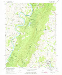
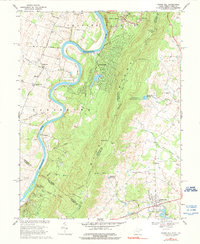
Editions of this 1970 Round Hill Map
3 editions found
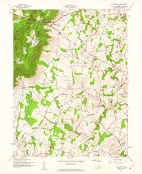
Other maps of this area

1884 · Harpers Ferry
USGS Topo · 1:125,000

1891 · Harpers Ferry
USGS Topo · 1:125,000

1893 · Harpers Ferry
USGS Topo · 1:125,000

1908 · Middletown
USGS Topo · 1:48,000

1910 · Antietam
USGS Topo · 1:62,500

1914 · Martinsburg
USGS Topo · 1:48,000

1916 · Martinsburg
USGS Topo · 1:62,500

1916 · Berryville
USGS Topo · 1:62,500

1939 · Berryville
USGS Topo · 1:48,000
1943 · Bluemont
USGS Topo · 1:24,000