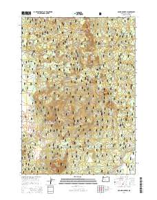
2014 Map of Round Mountain
USGS Topo · Published 2014About this map
Round Mountain and Lookout Mtn dominate this high-altitude landscape within the Deschutes National Forest of central Oregon. The terrain is characterized by a series of prominent volcanic features including Siah Butte, Lolah Butte, and Lumrum Butte, which rise above a network of forest development roads. Access to these peaks and the surrounding Cascade Range is provided by routes such as S Century Dr, Upper Deschutes Rd, and Lookout Mountain Rd. The map illustrates a complex topography of ridges and passes, notably Round Mountain Pass, where the drainage patterns of the high desert and mountain slopes meet. Unlike more settled regions, the infrastructure here is almost entirely dedicated to forest management and recreation, as evidenced by the dense grid of numbering for forest development roads and the lack of traditional town sites or civic buildings.
Find a feature on this map
30 named features on this map. Tap any name to fly to it.
Don’t see what you’re looking for? This feature index may not catch every label — zoom into the map to look around manually.
Map Details
Editions of this 2014 Round Mountain Map
This is the sole edition of this map. No revisions or reprints were ever made.
Other maps of this area

1930 · Maiden Peak
USGS Topo · 1:125,000

1934 · Maiden Peak
USGS Topo · 1:125,000

1955 · Crescent
USGS Topo · 1:250,000

1957 · Crescent
USGS Topo · 1:250,000

1958 · Crescent
USGS Topo · 1:250,000
1963 · Elk Lake
USGS Topo · 1:24,000

1963 · Round Mountain
USGS Topo · 1:24,000
1963 · Wanoga Butte
USGS Topo · 1:24,000

1963 · La Pine
USGS Topo · 1:24,000
1963 · Pistol Butte
USGS Topo · 1:24,000