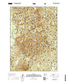
2020 Map of Round Mountain
USGS Topo · Published 2020About this map
Lookout Mtn and Round Mtn dominate this high-altitude landscape within the eastern reaches of the Cascade Range. This terrain is characterized by a series of volcanic peaks and ridges, including the distinct formations of Siah Butte, Lolah Butte, and Lumrum Butte. Much of the territory is managed as part of the Deschutes National Forest, where Forest Service roads like Edison # 34-4-2 provide the primary access through the dense woodland and over Round Mountain Pass. In the southeast corner, the headwaters or early stages of the Fall River emerge, contrasting the higher, drier volcanic features such as Dry Butte and the curious landmark known as Three Trappers. This survey provides a precise look at the modern forest management and topographic relief of this central Oregon wilderness.
Find a feature on this map
17 named features on this map. Tap any name to fly to it.
Don’t see what you’re looking for? This feature index may not catch every label — zoom into the map to look around manually.
Map Details
Editions of this 2020 Round Mountain Map
This is the sole edition of this map. No revisions or reprints were ever made.
Other maps of this area

1930 · Maiden Peak
USGS Topo · 1:125,000

1934 · Maiden Peak
USGS Topo · 1:125,000

1955 · Crescent
USGS Topo · 1:250,000

1957 · Crescent
USGS Topo · 1:250,000

1958 · Crescent
USGS Topo · 1:250,000
1963 · Elk Lake
USGS Topo · 1:24,000

1963 · Round Mountain
USGS Topo · 1:24,000
1963 · Wanoga Butte
USGS Topo · 1:24,000

1963 · La Pine
USGS Topo · 1:24,000
1963 · Pistol Butte
USGS Topo · 1:24,000