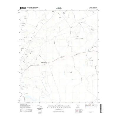
2014 Map of Round O
USGS Topo · Published 2014About this map
Round O serves as a central landmark in this Colleton County landscape, where rural life is defined by the winding paths of several drainage systems. The terrain is characterized by the low-lying reaches of Fuller Swamp Cr and Chessey Cr, which dictate the placement of local settlements and the road network. Important intersections like Drigger Crossroads and local clusters at Hiotts and Burr Hill show the persistent footprint of community centers in this part of the South Carolina Lowcountry. The map captures a transition where the higher ground of Davis Hill stands apart from the dense network of small waterways, such as Shereau Branch and Sandy Dam Br, which feed the larger swamp systems. This area is connected by established corridors like Wesley Chapel Rd and the Cottageville Hwy, illustrating the blend of traditional rural geography and modern infrastructure.
Find a feature on this map
84 named features on this map. Tap any name to fly to it.
Don’t see what you’re looking for? This feature index may not catch every label — zoom into the map to look around manually.
Map Details
Editions of this 2014 Round O Map
This is the sole edition of this map. No revisions or reprints were ever made.
Other maps of this area

1918 · Walterboro
USGS Topo · 1:62,500

1918 · Cottageville
USGS Topo · 1:62,500

1919 · Ridgeville
USGS Topo · 1:48,000

1920 · Ridgeville
USGS Topo · 1:62,500

1920 · St. George
USGS Topo · 1:48,000

1921 · St. George
USGS Topo · 1:62,500

1943 · Cottageville
USGS Topo · 1:62,500

1943 · Orangeburg
USGS Topo · 1:125,000

1943 · Walterboro
USGS Topo · 1:62,500

1943 · Ridgeville
USGS Topo · 1:62,500