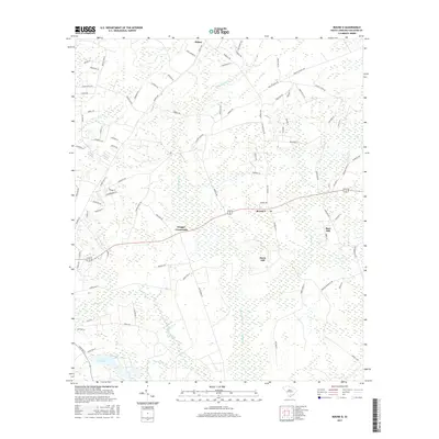
2017 Map of Round O
USGS Topo · Published 2017About this map
Round O and Drigger Crossroads serve as the primary junction points in this Lowcountry landscape, where the rural road network intersects with an extensive system of wetlands and slow-moving waterways. The terrain is characterized by broad drainage basins such as Fuller Swamp Cr and Chessey Cr, which define the low-lying reaches of Colleton County. Amidst the many named branches like Shergau Branch and Sandy Dam Br, a few topographic rises stand out, including Davis Hill and Burr Hill.
Find a feature on this map
89 named features on this map. Tap any name to fly to it.
Don’t see what you’re looking for? This feature index may not catch every label — zoom into the map to look around manually.
Map Details
Editions of this 2017 Round O Map
This is the sole edition of this map. No revisions or reprints were ever made.
Other maps of this area

1918 · Walterboro
USGS Topo · 1:62,500

1918 · Cottageville
USGS Topo · 1:62,500

1919 · Ridgeville
USGS Topo · 1:48,000

1920 · Ridgeville
USGS Topo · 1:62,500

1920 · St. George
USGS Topo · 1:48,000

1921 · St. George
USGS Topo · 1:62,500

1943 · Cottageville
USGS Topo · 1:62,500

1943 · Orangeburg
USGS Topo · 1:125,000

1943 · Walterboro
USGS Topo · 1:62,500

1943 · Ridgeville
USGS Topo · 1:62,500