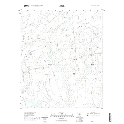
2020 Map of Round O
USGS Topo · Published 2020About this map
Round O and the surrounding Colleton County landscape are defined by an intricate network of wetlands and slow-moving watercourses. The settlement pattern is anchored by small communities such as Drigger Crossroads and Sidney, which sit amidst a terrain of low-lying savannas and swamps. The hydrologic character of the region is evident in the numerous named drainages like Fuller Swamp Cr, Shereau Br, and Sandy Dam Br that feed into larger systems. Local topography is subtle, with named rises like Davis Hill and Burr Hill providing slight elevation in an otherwise level environment. The map also captures the local water bodies that have served as community landmarks, including Lake Lucious. This survey illustrates a quiet, rural corner of the Lowcountry where the road system, including routes like Wesley Chapel Ave, navigates around the natural barriers formed by Logging Savanna and various unnamed wetlands.
Find a feature on this map
94 named features on this map. Tap any name to fly to it.
Don’t see what you’re looking for? This feature index may not catch every label — zoom into the map to look around manually.
Map Details
Editions of this 2020 Round O Map
This is the sole edition of this map. No revisions or reprints were ever made.
Other maps of this area

1918 · Walterboro
USGS Topo · 1:62,500

1918 · Cottageville
USGS Topo · 1:62,500

1919 · Ridgeville
USGS Topo · 1:48,000

1920 · Ridgeville
USGS Topo · 1:62,500

1920 · St. George
USGS Topo · 1:48,000

1921 · St. George
USGS Topo · 1:62,500

1943 · Cottageville
USGS Topo · 1:62,500

1943 · Orangeburg
USGS Topo · 1:125,000

1943 · Walterboro
USGS Topo · 1:62,500

1943 · Ridgeville
USGS Topo · 1:62,500