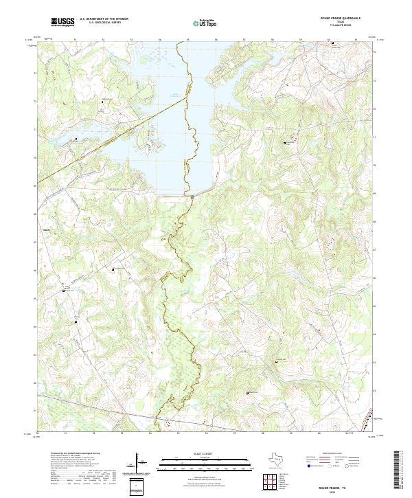
2022 Map of Round Prairie
USGS Topo · Published 2022About this map
Lake Limestone dominates the northern landscape of this region, where the borders of Limestone, Robertson, and Leon Counties converge. The topography is defined by the winding course of the Navasota River and its numerous tributaries, including Dogwood Cr, Birch Cr, and Long Hollow Creek. This area of East Texas is characterized by a high density of small family and community burial grounds, which serve as primary markers for genealogists and local historians.
Find a feature on this map
80 named features on this map. Tap any name to fly to it.
Don’t see what you’re looking for? This feature index may not catch every label — zoom into the map to look around manually.
Map Details
Editions of this 2022 Round Prairie Map
This is the sole edition of this map. No revisions or reprints were ever made.
Other maps of this area

1925 · Marquez No. 1
USGS Topo · 1:48,000

1927 · Marquez
USGS Topo · 1:62,500

1930 · Marquez
USGS Topo · 1:62,500

1954 · Waco
USGS Topo · 1:250,000

1955 · Waco
USGS Topo · 1:250,000

1956 · Jewett
USGS Topo · 1:62,500

1964 · Margie
USGS Topo · 1:24,000

1965 · Jewett
USGS Topo · 1:24,000
1965 · Marquez
USGS Topo · 1:24,000
1965 · Donie
USGS Topo · 1:24,000