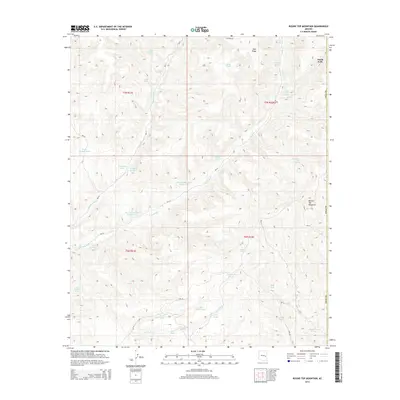
2014 Map of Round Top Mountain
USGS Topo · Published 2014About this map
Round Top Mountain anchors this high-elevation landscape in eastern Arizona, where a complex network of seasonal drainages and livestock tanks defines the land use of the mid-2010s. The terrain is deeply etched by the headwaters of Middle Cedar Cr and E Cedar Cr, reflecting a landscape managed for grazing and water conservation. Throughout the quadrangle, numerous named water sources like Upper Walnut Spring, Red Willow Spring, and Steer Pasture Spring indicate the critical importance of reliable water in this arid environment. The naming conventions for water features, such as Big Canyon Tank Number One and the G-five Farm Tank, suggest a coordinated approach to land management across these expansive townships. This period of the Navajo County survey captures the area's transition into Amos Wash, illustrating the subtle topographic shifts that guide the region's intermittent hydrology and ranching infrastructure.
Find a feature on this map
39 named features on this map. Tap any name to fly to it.
Don’t see what you’re looking for? This feature index may not catch every label — zoom into the map to look around manually.
Map Details
Editions of this 2014 Round Top Mountain Map
This is the sole edition of this map. No revisions or reprints were ever made.
Other maps of this area

1886 · St Johns
USGS Topo · 1:250,000

1886 · Holbrook
USGS Topo · 1:250,000

1892 · St Johns
USGS Topo · 1:250,000

1893 · Holbrook
USGS Topo · 1:250,000

1954 · Holbrook
USGS Topo · 1:250,000

1954 · Clifton
USGS Topo · 1:250,000

1954 · Saint Johns
USGS Topo · 1:250,000

1954 · Mesa
USGS Topo · 1:250,000

1957 · Mesa
USGS Topo · 1:250,000

1957 · Holbrook
USGS Topo · 1:250,000