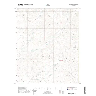
2018 Map of Round Top Mountain
USGS Topo · Published 2018About this map
Round Top Mtn and the high elevations of Lake Ridge dominate this section of Navajo County, defining a landscape shaped by drainage systems like Amos Wash and the various branches of Middle Cedar Creek. The 2018 survey reveals a territory primarily organized around water management and livestock ranching, evidenced by a dense network of springs and named tanks. Notable water sources include Red Willow Spring, Eightyfive Bar Spring, and Upper Walnut Spring, which served as critical points for high-country life. The presence of features like G-five Farm Tank and Horse Pasture Tank suggests a legacy of specialized land use. This map provides a detailed record of the backcountry infrastructure, including remote roads such as Co RD 833 and Co RD 812 that connect these high-altitude ranges.
Find a feature on this map
44 named features on this map. Tap any name to fly to it.
Don’t see what you’re looking for? This feature index may not catch every label — zoom into the map to look around manually.
Map Details
Editions of this 2018 Round Top Mountain Map
This is the sole edition of this map. No revisions or reprints were ever made.
Other maps of this area

1886 · St Johns
USGS Topo · 1:250,000

1886 · Holbrook
USGS Topo · 1:250,000

1892 · St Johns
USGS Topo · 1:250,000

1893 · Holbrook
USGS Topo · 1:250,000

1954 · Holbrook
USGS Topo · 1:250,000

1954 · Clifton
USGS Topo · 1:250,000

1954 · Saint Johns
USGS Topo · 1:250,000

1954 · Mesa
USGS Topo · 1:250,000

1957 · Mesa
USGS Topo · 1:250,000

1957 · Holbrook
USGS Topo · 1:250,000