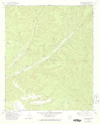
1978 Map of Round Top MTN
USGS Topo · Published 1978About this map
The high-country terrain of the Fort Apache Indian Reservation is defined here by the deep incisions of Big Canyon and the branching waters of Middle Cedar Creek and East Cedar Creek. Located along the border of Gila and Navajo counties, the landscape is heavily marked by livestock and resource management infrastructure. Named water sources like Upper Walnut Spring, Bear Spring, and Banana Spring dot the ridges and canyons, while numerous tanks such as Walker Tank and the Horse Pasture Tank support the high-altitude grazing lands. The topography is anchored by the prominent Round Top Mtn, rising near a small Gravel Pit and a network of jeep trails. This 1970s survey, revised by the Bureau of Indian Affairs, offers an intricate look at the hydrology and land use within the reservation before modern developments shifted the character of these remote uplands.
Find a feature on this map
37 named features on this map. Tap any name to fly to it.
Don’t see what you’re looking for? This feature index may not catch every label — zoom into the map to look around manually.
Map Details
Editions of this 1978 Round Top MTN Map
This is the sole edition of this map. No revisions or reprints were ever made.
Other maps of this area

1886 · St Johns
USGS Topo · 1:250,000

1886 · Holbrook
USGS Topo · 1:250,000

1892 · St Johns
USGS Topo · 1:250,000

1893 · Holbrook
USGS Topo · 1:250,000

1954 · Holbrook
USGS Topo · 1:250,000

1954 · Clifton
USGS Topo · 1:250,000

1954 · Saint Johns
USGS Topo · 1:250,000

1954 · Mesa
USGS Topo · 1:250,000

1957 · Mesa
USGS Topo · 1:250,000

1957 · Holbrook
USGS Topo · 1:250,000