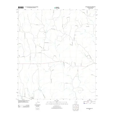
2012 Map of Roundhead
USGS Topo · Published 2012About this map
Tivydale and the namesake high ground of Roundhead anchor this 2012 survey of the Gillespie County landscape. The area is defined by a dense network of seasonal and perennial waterways, including Devils Cr, Mormon Cr, and Honey Cr, which carve through the Texas Hill Country terrain. The presence of Tivydale Ranch Airport near the southern boundary suggests the intersection of rural ranching traditions with modern regional infrastructure.
Find a feature on this map
51 named features on this map. Tap any name to fly to it.
Don’t see what you’re looking for? This feature index may not catch every label — zoom into the map to look around manually.
Map Details
Editions of this 2012 Roundhead Map
This is the sole edition of this map. No revisions or reprints were ever made.
Other maps of this area

1894 · Fredericksburg
USGS Topo · 1:125,000

1894 · Kerrville
USGS Topo · 1:125,000

1954 · Llano
USGS Topo · 1:250,000

1955 · Llano
USGS Topo · 1:250,000

1956 · Llano
USGS Topo · 1:250,000

1964 · Oak Crest Park
USGS Topo · 1:24,000

1964 · Morris Ranch
USGS Topo · 1:24,000

1964 · Nott Branch
USGS Topo · 1:24,000
1967 · Harper East
USGS Topo · 1:24,000
1967 · Cherry Mountain
USGS Topo · 1:24,000