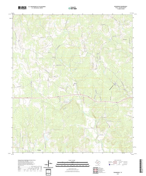
2022 Map of Roundhead
USGS Topo · Published 2022About this map
Tivydale anchors the southern portion of this landscape, situated in a region defined by the complex branching of the Spring Cr and Dittmar Cr watersheds. The area is characterized by numerous family-named roads and ranch lands, including Reeh Weinheimer Rd and Poverty Hill Ranch Rd, which reflect the long-standing agricultural and ranching heritage of Gillespie County. Near the center of the map, the Spring Creek Cem serves as a significant genealogical marker, located just north of the crossing at US Highway 290.
Find a feature on this map
57 named features on this map. Tap any name to fly to it.
Don’t see what you’re looking for? This feature index may not catch every label — zoom into the map to look around manually.
Map Details
Editions of this 2022 Roundhead Map
This is the sole edition of this map. No revisions or reprints were ever made.
Other maps of this area

1894 · Fredericksburg
USGS Topo · 1:125,000

1894 · Kerrville
USGS Topo · 1:125,000

1954 · Llano
USGS Topo · 1:250,000

1955 · Llano
USGS Topo · 1:250,000

1956 · Llano
USGS Topo · 1:250,000

1964 · Oak Crest Park
USGS Topo · 1:24,000

1964 · Morris Ranch
USGS Topo · 1:24,000

1964 · Nott Branch
USGS Topo · 1:24,000
1967 · Harper East
USGS Topo · 1:24,000
1967 · Cherry Mountain
USGS Topo · 1:24,000