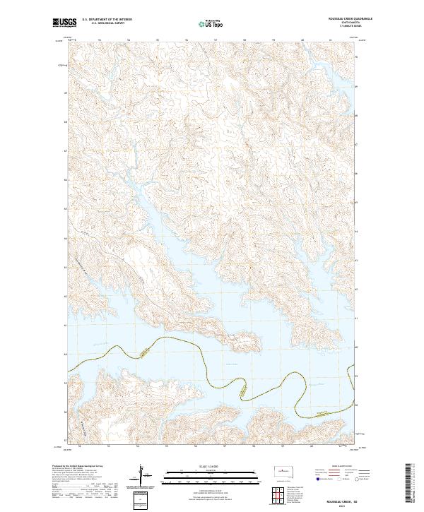
2021 Map of Rousseau Creek
USGS Topo · Published 2021About this map
Lake Oahe and the Missouri River dominate this modern topographical record of the boundary between Dewey and Stanley counties. The landscape is defined by the extensive drainage systems of Rousseau Cr, including its eastern and western branches, which carve through the high ground before meeting the reservoir's expansive waters. The topographic relief is further illustrated by named landforms such as Fine Weather Draw and Whiteman Draw, showing the intricate erosion patterns characteristic of this region of South Dakota.
Find a feature on this map
20 named features on this map. Tap any name to fly to it.
Don’t see what you’re looking for? This feature index may not catch every label — zoom into the map to look around manually.
Map Details
Editions of this 2021 Rousseau Creek Map
This is the sole edition of this map. No revisions or reprints were ever made.
Other maps of this area

1954 · Pierre
USGS Topo · 1:250,000

1956 · Rousseau Creek SW
USGS Topo · 1:24,000

1956 · Crockett Mountains
USGS Topo · 1:24,000

1958 · Pierre
USGS Topo · 1:250,000

1969 · Rousseau Creek
USGS Topo · 1:24,000

1969 · No Heart Creek SW
USGS Topo · 1:24,000

1973 · Iron Post Buttes
USGS Topo · 1:24,000

1981 · Charlie Creek
USGS Topo · 1:24,000

1981 · Rousseau Creek NW
USGS Topo · 1:24,000
1981 · No Heart Creek
USGS Topo · 1:24,000