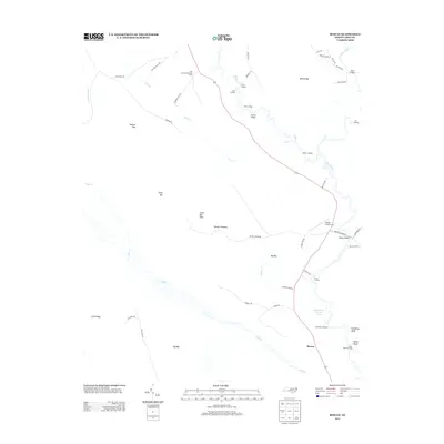
2013 Map of Rowan
USGS Topo · Published 2013About this map
Black River and the S River define the eastern landscape of this North Carolina quadrangle, where a series of historical river access points like Tar Landing, Bakers Landing, and Sikes Landing speak to the area's maritime heritage. The settlement of Rowan sits in the southern portion of the map, connected to the north by Highway 210. The terrain is characterized by a high concentration of Carolina bays—unique elliptical depressions such as Tussock Bay, Camp Bay, Big Bay, and Dismal Bay—which dot the coastal plain between the river systems.
Find a feature on this map
52 named features on this map. Tap any name to fly to it.
Don’t see what you’re looking for? This feature index may not catch every label — zoom into the map to look around manually.
Map Details
Editions of this 2013 Rowan Map
This is the sole edition of this map. No revisions or reprints were ever made.
Other maps of this area

1953 · Florence
USGS Topo · 1:250,000

1954 · Florence
USGS Topo · 1:250,000

1954 · White Lake
USGS Topo · 1:62,500

1954 · Acme
USGS Topo · 1:62,500

1954 · Bolton
USGS Topo · 1:62,500

1955 · Atkinson
USGS Topo · 1:62,500
1980 · Point Caswell
USGS Topo · 1:24,000

1982 · Elizabethtown
USGS Topo · 1:100,000
1983 · Point Caswell
USGS Topo · 1:24,000
1984 · Harrells
USGS Topo · 1:24,000