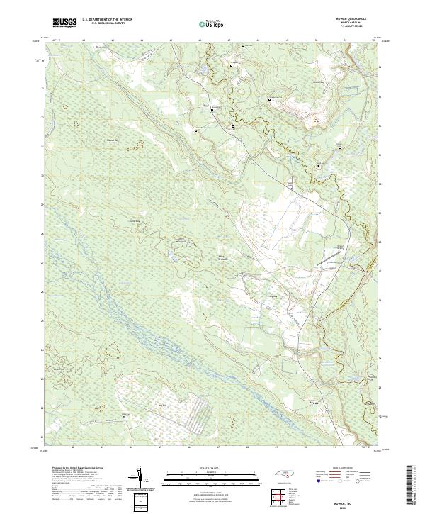
2022 Map of Rowan
USGS Topo · Published 2022About this map
The lowlands of the South River and Black River converge in this corner of North Carolina, creating an intricate network of Carolina bays and swampy depressions. Small settlements like Rowan and Reedy Crossway occupy the slightly higher ground between expansive wetland features such as Big Bay, Dismal Bay, and Tussock Bay. The landscape is heavily marked by local family history, evidenced by a high density of small burial grounds including Salem Cem, Sellars Cem, and Pridgen Cem that dot the wooded fringes of the wetlands.
Find a feature on this map
64 named features on this map. Tap any name to fly to it.
Don’t see what you’re looking for? This feature index may not catch every label — zoom into the map to look around manually.
Map Details
Editions of this 2022 Rowan Map
This is the sole edition of this map. No revisions or reprints were ever made.
Other maps of this area

1953 · Florence
USGS Topo · 1:250,000

1954 · Florence
USGS Topo · 1:250,000

1954 · White Lake
USGS Topo · 1:62,500

1954 · Acme
USGS Topo · 1:62,500

1954 · Bolton
USGS Topo · 1:62,500

1955 · Atkinson
USGS Topo · 1:62,500
1980 · Point Caswell
USGS Topo · 1:24,000

1982 · Elizabethtown
USGS Topo · 1:100,000
1983 · Point Caswell
USGS Topo · 1:24,000
1984 · Harrells
USGS Topo · 1:24,000