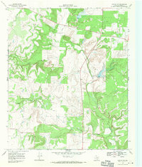
1968 Map of Rowden NW
USGS Topo · Published 1971About this map
North Prong Pecan Bayou and South Prong Pecan Bayou converge in this section of Callahan County, carving a landscape defined by seasonal watercourses and upland divides. The late 1960s terrain shows a rural Texas economy transitioning between traditional ranching and active resource extraction. Evidence of industry is scattered throughout the drainages, notably with Oil Wells and a Drill Hole located near the northern prong, alongside various Gravel Pits that suggest local infrastructure development. The presence of a Roadside Park along the primary north-south thoroughfare highlights the integration of early highway travel into the remote landscape. Smaller tributaries like Clear Creek, Bear Branch, and Condemny Branch further define the local hydrology, providing a detailed look at the drainage patterns that shaped land use and settlement in this part of West Central Texas.
Find a feature on this map
10 named features on this map. Tap any name to fly to it.
Don’t see what you’re looking for? This feature index may not catch every label — zoom into the map to look around manually.
Map Details
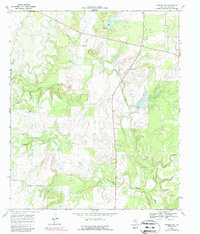
Editions of this 1968 Rowden NW Map
2 editions found
Other maps of this area

1890 · Abilene
USGS Topo · 1:125,000

1892 · Abilene
USGS Topo · 1:125,000

1931 · Baird
USGS Topo · 1:125,000

1932 · Baird
USGS Topo · 1:125,000

1954 · Abilene
USGS Topo · 1:250,000

1957 · Kirby Lake
USGS Topo · 1:62,500

1958 · Abilene
USGS Topo · 1:250,000
1960 · Webbville
USGS Topo · 1:24,000
1960 · Crooked Creek
USGS Topo · 1:24,000

1966 · Admiral
USGS Topo · 1:24,000