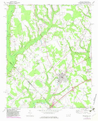
1972 Map of Rowland
USGS Topo · Published 1983About this map
Rowland serves as the primary hub in this early 1970s survey of the North Carolina and South Carolina borderlands. The town is defined by its grid near the Seaboard Coast Line railroad and local infrastructure such as the Athletic Field and Southside Sch. To the west, the landscape transitions into a dense network of blackwater drainages including Ashpole Swamp, Hayes Swamp, and Persimmon Swamp. The survey captures a rural social geography anchored by numerous country churches, such as Salem Ch and Mt Pelier Ch, and small crossroads settlements like Alfordsville and Purvis. This map is particularly valuable for tracing the precise alignment of the state line across Robeson Co and Dillon Co, where local landmarks like the State Line Ch Cem and the Baker Cem sit right at the boundary. The presence of several Landing Strips and local industry like the Claypit near the border highlights the era's rural economic activities.
Find a feature on this map
40 named features on this map. Tap any name to fly to it.
Don’t see what you’re looking for? This feature index may not catch every label — zoom into the map to look around manually.
Map Details
Editions of this 1972 Rowland Map
2 editions found
Other maps of this area

1943 · Pages Mill
USGS Topo · 1:62,500

1953 · Florence
USGS Topo · 1:250,000

1954 · Florence
USGS Topo · 1:250,000

1960 · Dillon East
USGS Topo · 1:24,000

1960 · Dillon West
USGS Topo · 1:24,000

1962 · Gaddysville
USGS Topo · 1:24,000

1962 · Fair Bluff
USGS Topo · 1:62,500

1971 · Minturn
USGS Topo · 1:24,000

1971 · Johns
USGS Topo · 1:24,000

1972 · Pembroke
USGS Topo · 1:24,000