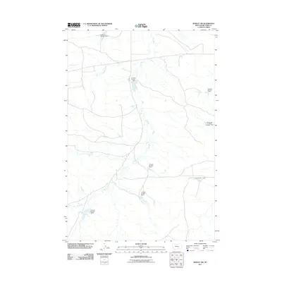
2011 Map of Rowley NW
USGS Topo · Published 2011About this map
Fly Creek and Telegraph Creek wind through this Big Horn County landscape, defining a region where water management is central to the land's utility. The area is marked by a sophisticated network of private and communal water engineering, featuring numerous reservoirs such as Kjeldgaard Number 2 Dam and the expansive J R Scott Number 9 Dam. These structures illustrate the logistical efforts required to support ranching or agriculture in this part of Montana.
Find a feature on this map
12 named features on this map. Tap any name to fly to it.
Don’t see what you’re looking for? This feature index may not catch every label — zoom into the map to look around manually.
Map Details
Editions of this 2011 Rowley NW Map
This is the sole edition of this map. No revisions or reprints were ever made.
Other maps of this area

1893 · Huntley
USGS Topo · 1:125,000

1894 · Fort Custer
USGS Topo · 1:125,000

1954 · Billings
USGS Topo · 1:250,000

1954 · Hardin
USGS Topo · 1:250,000

1957 · Hardin
USGS Topo · 1:250,000

1957 · Billings
USGS Topo · 1:250,000

1958 · Billings
USGS Topo · 1:250,000

1958 · Hardin
USGS Topo · 1:250,000
1969 · Rowley NW
USGS Topo · 1:24,000
1969 · Rowley
USGS Topo · 1:24,000