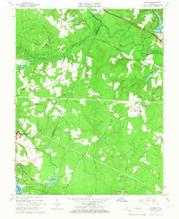
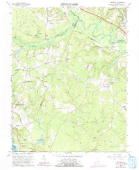
1965 Map of Roxbury
USGS Topo · Published 1967About this map
Glendale National Cemetery and parts of the Richmond National Battlefield Park anchor this mid-1960s survey of the Virginia Peninsula at the junction of Henrico, Charles City, and New Kent counties. The landscape is a mix of dense forest, swampy bottomlands, and scattered agriculture, defined by the winding Chickahominy River and the broad White Oak Swamp. Settlement is clustered around historic crossroads like Glendale, Roxbury, and Nance, while the Chesapeake and Ohio railroad cuts through the northern timberlands.
Find a feature on this map
59 named features on this map. Tap any name to fly to it.
Don’t see what you’re looking for? This feature index may not catch every label — zoom into the map to look around manually.
Map Details
Editions of this 1965 Roxbury Map
5 editions found
Other maps of this area

1894 · Bermuda Hundred
USGS Topo · 1:62,500

1894 · Richmond
USGS Topo · 1:62,500

1895 · Richmond
USGS Topo · 1:62,500

1918 · Charles City
USGS Topo · 1:62,500

1920 · King William
USGS Topo · 1:62,500

1934 · Seven Pines
USGS Topo · 1:24,000

1938 · Dutch Gap
USGS Topo · 1:24,000

1938 · Seven Pines
USGS Topo · 1:31,680

1943 · Dutch Gap
USGS Topo · 1:31,680

1943 · Hopewell
USGS Topo · 1:31,680