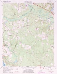
1965 Map of Roxbury
USGS Topo · Published 1984About this map
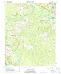
Malvern Hill Battlefield and sections of the Richmond National Battlefield Park anchor the southwestern portion of this survey, marking the site of significant Civil War conflicts. The landscape is defined by the drainage of the Chickahominy River and the expansive White Oak Swamp, which historically influenced troop movements and settlement patterns between Henrico and Charles City counties. The Chesapeake and Ohio railroad corridor cuts across the north, connecting small rural hubs like Roxbury and Elko.
Find a feature on this map
56 named features on this map. Tap any name to fly to it.
Don’t see what you’re looking for? This feature index may not catch every label — zoom into the map to look around manually.
Map Details
Editions of this 1965 Roxbury Map
5 editions found
Other maps of this area

1894 · Bermuda Hundred
USGS Topo · 1:62,500

1894 · Richmond
USGS Topo · 1:62,500

1895 · Richmond
USGS Topo · 1:62,500

1918 · Charles City
USGS Topo · 1:62,500

1920 · King William
USGS Topo · 1:62,500

1934 · Seven Pines
USGS Topo · 1:24,000

1938 · Dutch Gap
USGS Topo · 1:24,000

1938 · Seven Pines
USGS Topo · 1:31,680

1943 · Dutch Gap
USGS Topo · 1:31,680

1943 · Hopewell
USGS Topo · 1:31,680