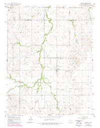
1964 Map of Roxbury
USGS Topo · Published 1980About this map
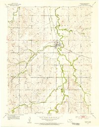
Roxbury serves as the central hub of this agricultural and extraction-based landscape in northern McPherson County. The topography is defined by the winding course of Gypsum Creek and its many tributaries, including South Gypsum Creek, Battle Creek, and Spring Creek, which carve through the townships of Liberty, Gypsum, and Delmore. The presence of several energy and resource sites, such as the South Roxbury Field and various Oil Wells, indicates the region's mid-century reliance on petroleum. Genealogists will find notable burial sites like Valley View Memorial Cem and Eureka Cem positioned near the primary settlements and waterways. Distinctive natural landmarks such as the Twin Mounds and the prominent Battle Hill rise above the drainage basins, while the Saline and McPherson county line marks the northern boundary of the survey area.
Find a feature on this map
24 named features on this map. Tap any name to fly to it.
Don’t see what you’re looking for? This feature index may not catch every label — zoom into the map to look around manually.
Map Details
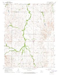
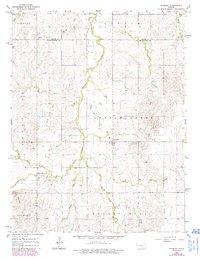
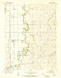
Editions of this 1964 Roxbury Map
3 editions found
Other maps of this area

1889 · Newton
USGS Topo · 1:125,000

1889 · Abilene
USGS Topo · 1:125,000

1891 · Hutchinson
USGS Topo · 1:125,000

1892 · Salina
USGS Topo · 1:125,000

1893 · Hutchinson
USGS Topo · 1:125,000

1894 · Newton
USGS Topo · 1:125,000

1894 · Abilene
USGS Topo · 1:125,000

1942 · Salina
USGS Topo · 1:125,000
1955 · Assaria
USGS Topo · 1:24,000
1955 · Gypsum
USGS Topo · 1:24,000