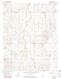
1964 Map of Roxbury
USGS Topo · Published 1985About this map
Gypsum Creek and its many tributaries, including South Gypsum Creek and Stag Creek, define the drainage patterns across this section of the Kansas plains. The settlement of Roxbury serves as the central hub of activity, surrounded by an landscape that shows clear evidence of both agricultural and industrial use. Numerous oil fields and individual oil wells are scattered across the terrain, particularly in the areas of Bonaville and Crowther. For those researching local family history, the map provides precise locations for the Valley View Memorial Cem and Eureka Cem. The topography is punctuated by prominent natural landmarks such as Twin Mounds and the elevation of Battle Hill near Battle Creek, while a large pipeline and several oil wells indicate the energy infrastructure that supported the mid-century economy in McPherson County.
Find a feature on this map
25 named features on this map. Tap any name to fly to it.
Don’t see what you’re looking for? This feature index may not catch every label — zoom into the map to look around manually.
Map Details
Editions of this 1964 Roxbury Map
3 editions found
Other maps of this area

1889 · Newton
USGS Topo · 1:125,000

1889 · Abilene
USGS Topo · 1:125,000

1891 · Hutchinson
USGS Topo · 1:125,000

1892 · Salina
USGS Topo · 1:125,000

1893 · Hutchinson
USGS Topo · 1:125,000

1894 · Newton
USGS Topo · 1:125,000

1894 · Abilene
USGS Topo · 1:125,000

1942 · Salina
USGS Topo · 1:125,000

1955 · Assaria
USGS Topo · 1:24,000

1955 · Gypsum
USGS Topo · 1:24,000