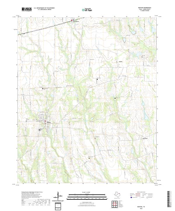
2022 Map of Roxton
USGS Topo · Published 2022About this map
Roxton serves as the primary hub for this agricultural portion of Lamar County, where a dense network of county roads connects scattered rural communities and family burial grounds. The landscape is defined by the drainages of Maxwell Cr and Mallory Cr, which wind through the prairie toward the south. The distribution of cemeteries across the terrain—ranging from Restland Cem near the town center to more isolated sites like Killingsworth Cem and Rice Cem—suggests a deeply rooted pattern of family landholdings and historic settlements. Significant local infrastructure includes the convergence of FM 38 and FM 137 in Roxton, alongside smaller locales such as Brookston and Ambia. These maps provide essential documentation for genealogists tracing ancestors in the Red River Valley hinterlands, showing the spatial relationship between old homesteads and the numerous namesake creeks like Denton Cr and Justiss Cr.
Find a feature on this map
82 named features on this map. Tap any name to fly to it.
Don’t see what you’re looking for? This feature index may not catch every label — zoom into the map to look around manually.
Map Details
Editions of this 2022 Roxton Map
This is the sole edition of this map. No revisions or reprints were ever made.
Other maps of this area

1903 · Paris
USGS Topo · 1:125,000

1947 · Honey Grove
USGS Topo · 1:62,500

1948 · Paris
USGS Topo · 1:62,500

1949 · Honey Grove
USGS Topo · 1:62,500

1949 · Paris
USGS Topo · 1:62,500

1953 · Texarkana
USGS Topo · 1:250,000

1956 · Texarkana
USGS Topo · 1:250,000

1964 · Charleston
USGS Topo · 1:24,000

1964 · Cooper North
USGS Topo · 1:24,000

1964 · Pecan Gap
USGS Topo · 1:24,000