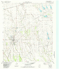
1984 Map of Roxton
USGS Topo · Published 1984About this map
Roxton and its surrounding prairie landscapes are defined by an intricate network of waterways and a deep history of rural settlement in Lamar County. The town serves as a central hub for agricultural activity, while smaller communities like High, Brookston (BM 603), Ambia, and Howland are connected by the tracks of the Missouri Pacific and the Atchison Topeka And Santa Fe. A significant genealogical record is preserved across the terrain, with numerous family and community burial sites such as Mc Glasson Cem, Topping Cem, and Dickie Cem dotting the areas between Maxwell Creek and Mallory Creek. The presence of an Old Railroad Grade near Howland provides a look at the shifting transportation priorities of the mid-20th century. Local social life is evidenced by the Rodeo Ground near the town center, while industrial activity is represented by several Gravel Pit operations scattered along the creek basins.
Find a feature on this map
27 named features on this map. Tap any name to fly to it.
Don’t see what you’re looking for? This feature index may not catch every label — zoom into the map to look around manually.
Map Details
Editions of this 1984 Roxton Map
This is the sole edition of this map. No revisions or reprints were ever made.
Other maps of this area

1903 · Paris
USGS Topo · 1:125,000

1947 · Honey Grove
USGS Topo · 1:62,500

1948 · Paris
USGS Topo · 1:62,500

1949 · Honey Grove
USGS Topo · 1:62,500

1949 · Paris
USGS Topo · 1:62,500

1953 · Texarkana
USGS Topo · 1:250,000

1956 · Texarkana
USGS Topo · 1:250,000

1964 · Charleston
USGS Topo · 1:24,000

1964 · Cooper North
USGS Topo · 1:24,000

1964 · Pecan Gap
USGS Topo · 1:24,000